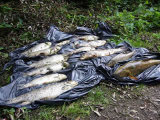
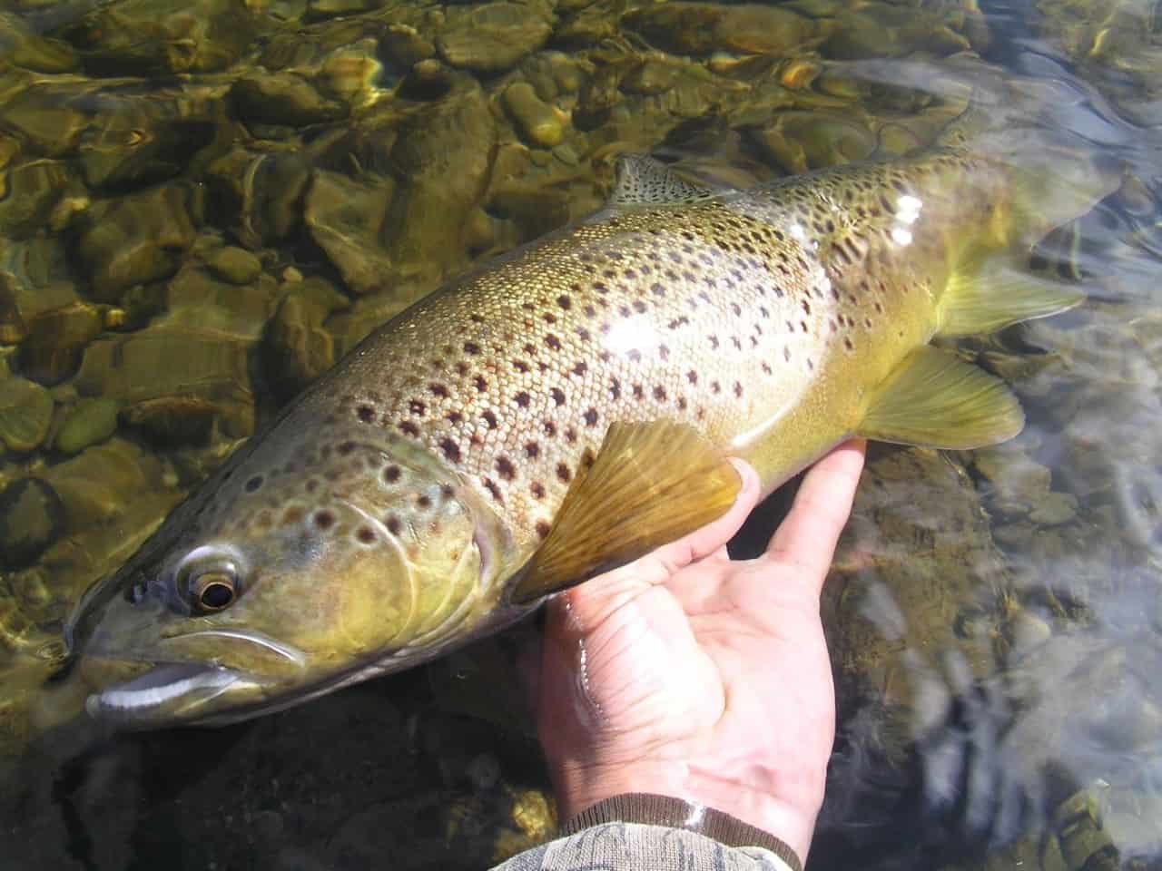
The South East Rivers Trust notes today’s judgement at Lewes Crown Court that Thames Water has been fined £3.3million for polluting a section of the River Mole near Gatwick Airport on October 11, 2017.
About 1,400 fish were killed in the incident on the River Mole between Crawley in Sussex and Horley in Surrey.
In a statement, SERT said:
“There is no excuse for polluting rivers which are the lifeblood of our landscapes. This incident decimated fish populations on the Gatwick Stream and impacted the ecology of the river far beyond into the catchment of the River Mole.
“Six years after this pollution incident the river and local angling club are still suffering.
“We welcome Thames Water’s fine, while hoping it would have been higher.
“We are furious to hear the Judge’s conclusion that Thames Water attempted to mislead the regulator.
“They have asked to work with us to help repair the damage by providing £1m in the form of a voluntary reparation to help improve the river’s habitat and water quality that is so important to the local community.”
SERT is already using the voluntary reparation to improve the health and resilience of the Gatwick Stream and other waterways impacted by this pollution event.
The money is being used to fund projects, such as the Caring for Crawley’s Rivers project, that improve the quality of the river habitat, identify and remedy systematic water quality issues in the catchment, and engage local communities in the health of their rivers, including carrying out education sessions.
SERT will also be working to gather data and evidence to support the development and deployment of these remediation projects and to monitor their success.
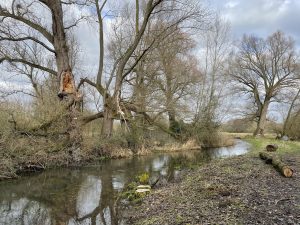
In the first of two blogs, Dr Chris Gardner, head of our Science and Partnerships team, outlines some of the problems caused by weirs on habitats and fish. This has a particular focus on the River Darent in Kent, where we have recently carried out several pieces of work as we try to help fish species move along the whole river catchment.
Restoring rivers to help wildlife
The term “river restoration” describes a set of activities that help improve the environmental health of a river or stream. These activities aim to restore the natural state and functionality of the river system to promote improved fish populations, biodiversity, recreation, flood management and development.
Restoration tends to focus on increasing habitat quality and diversity. A popular first step to achieving this is to overcome barriers such as weirs, increasing the access animals have to the existing range of habitats available in the catchment.
Over the centuries, we have adapted rivers for our own use, modifying them to facilitate land use for agriculture and development, navigation, water supply, power generation and other priorities.
Fish and other aquatic organisms evolved in rivers long before humans had this influence, and so they have not adapted to the modifications we have made, such as concrete banks, deep dredged sections, straight uniform channels and weirs, all of which block their passage.
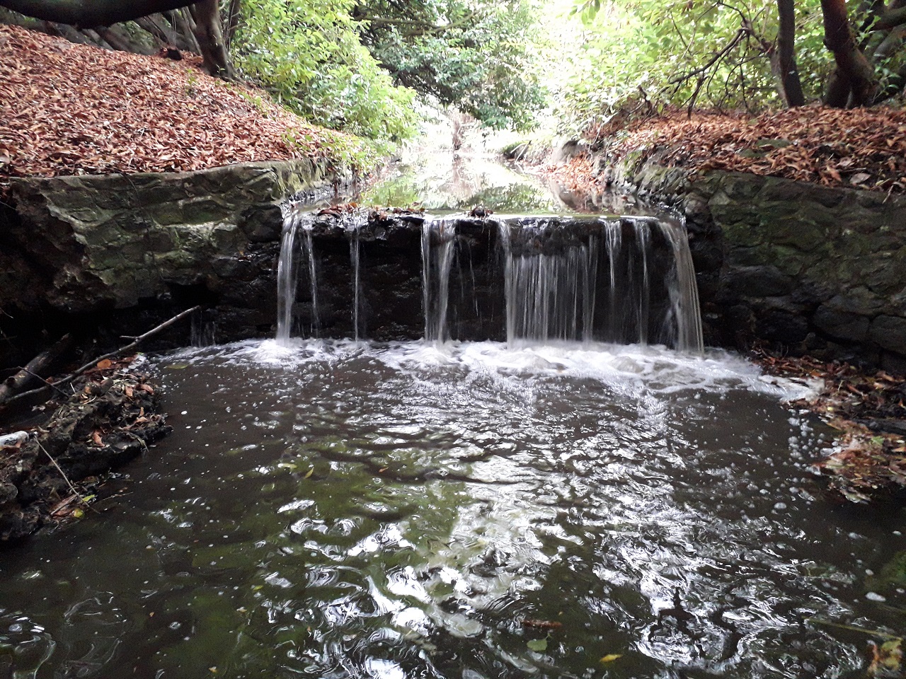
Weirs impact rivers in three main ways
Tanners Weir at Sundridge on the River Darent, which is totally impassable by fish, fragmenting the habitat available for them to utilise
Habitat fragmentation
This is frequently caused by human activities which disrupt the continuity of habitats used by wildlife and is a land conservation issue as well as an aquatic one. Habitats which were once continuous become divided into separate fragments, restricting the movements of organisms (for example fish) and separating them from habitats, natural resources and other fish required for their survival or the completion of their life-cycle.
Fragmented habitats are also less resilient, preventing re-colonisation after pollution incidents and lowering genetic variability because of the restricted, effective population size, potentially placing populations at an evolutionary disadvantage.
River habitat
This is degraded in quality because an enclosed – or “impounded” – area is created upstream. In other words, river-like habitats become lake-like – stiller, with less water flow than a natural river should be. This drowns out natural features such as riffles (a shallow place in a river where water flows quickly past rocks) causing the loss of important spawning and nursery habitats for river fishes, thus lowering the numbers of fish and breeding success.
Rivers are naturally dynamic with erosion and deposition occurring in balance, creating a highly varied mosaic of temporal micro-habitats for all life-stages of fishes.
An impounded area of river above a large sluice/weir on the River Medway. The river becomes still, affecting vegetation and animals
Weirs stop this natural tendency for change, creating a uniform, static environment. Upstream, an over deep river channel, similar to a lowland river, is formed in the impounded area, which might be inappropriate for the fish community (for instance, barbel habitat may become bream habitat). Impoundments also alter the temperature regime, oxygen content and cause sediment build up (siltation) in the upstream impounded area.
Sediment transport
Natural processes, such as moving sediment along a river, are prevented by weirs and instead the sediment stays in one place, covering the riverbed. This inhibits the riverbed’s function as a feeding and breeding ground. In a natural river, sediment (for example gravel) is shaped and sorted by water flow patterns. This creates a large diversity of ever-changing habitat types that support a rich diversity of wildlife.
Weirs stop natural processes and impact river channels in two main ways:
Upstream – Sediment transport is interrupted by the weir. Instead, it accumulates upstream. The lack of energy in the impounded area causes the sediment to not be shaped and sorted by the water flow and therefore creates a uniform habitat that supports less diversity of wildlife.
Downstream – Sediment transport is interrupted by the weir, reducing the supply of sediment (for example gravel) to the downstream reach, which is vital for creating habitat features for wildlife. This lack of sediment from upstream leads to increased erosion of riverbanks and riverbed, leading to “channel incision”. This is when the river begins at one height and cuts downward (incises) through its bed while leaving its floodplain behind [higher up] throughout its course.
Incised channels have knock-on impacts for:
A section of free-flowing River Darent at Shoreham. Shallow gravel riffles supporting abundant growth of Water Crowfoot, ideal spawning and nursey habitat for native brown trout.
Ecology:
The incised channel only connects to its floodplain in extreme flood events, when higher than normal water velocity is maintained in-channel during small to medium flood events. Aquatic wildlife, such as juvenile fishes, may become swept downstream during high flow events. The steep banks also cause a lack of marginal transitional habitats which provide a refuge for wildlife in flood conditions.
Flooding downstream:
Flood risk may increase downstream, again caused because the incised channel cannot connect to its floodplain other than during extreme flood events. The problem is simply shifted downstream.
Addressing the impacts of weirs
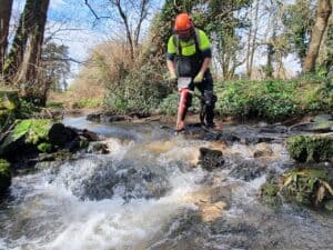
The Brasted Lower Weir being removed by drill
Removal of the weir should always be the considered as the preferred option, which solves all the issues described above. However, total removal is often not possible because of the way the landscape has developed since the weir was built.
Other factors that need to be considered include the wishes of landowners and river users, such as anglers, who might value the weir and its effect on the river.
The next best option might be a partial removal (lowering of the weir) and/or the implementation of a fish passage, which solves part of one problem (reducing the impounded reach) and all of another (connecting the upstream and downstream habitats). Fish passage solutions include natural bypass channels (which are preferred as they create additional habitat) rock ramps and baffles, as installed in 2023 by SERT at the Quester weir.
Essentially, any “solution” needs to provide fish with free movement and suit a range of fish sizes and flow speeds and depths that might be experienced at various times of the year.
A natural bypass channel around an impassable weir on the River Darent, at Sundridge, Kent.
It also need to be delivered with usually tight budgets available.
Modelling, using an existing locally specific Environment Agency flood model is used to satisfy these needs and ensures no increase in flood risk for any nearby residential properties.
This approach is best practice and gives all interested parties the confidence to implement solutions with the simplest, and most cost effective design.
The health of the UK’s rivers is increasingly at the forefront of the public consciousness. It is therefore vital that organisations working to protect and restore our rivers communicate openly and effectively with the public through innovative channels. It is also vital that all organisations working on a river network combine their efforts in a collective approach. What happens upstream affects the downstream.
We are delighted to launch the latest in our series of catchment ArcGIS Storymaps, on behalf of the wider River Mole catchment partnership. This partnership brings together about 45 organisations and individuals who are committed to protecting and enhancing the health of the watercourses across the entire river network. The South East Rivers Trust (SERT) co-hosts the partnership with the Surrey Wildlife Trust.
Through the River Mole Storymap anyone interested in the multiple threats to the river’s health, and the activities of the Catchment Partnership which aim to mitigate those threats, will be able to access detailed information, beautifully mapped for context and understanding.
Below, Dr Lewis Campbell, the Catchment Manager, provides a brief introduction to the Mole catchment, and highlights the work some of the organisations involved in its care and restoration.
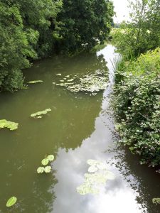
Clay and chalk bring different issues
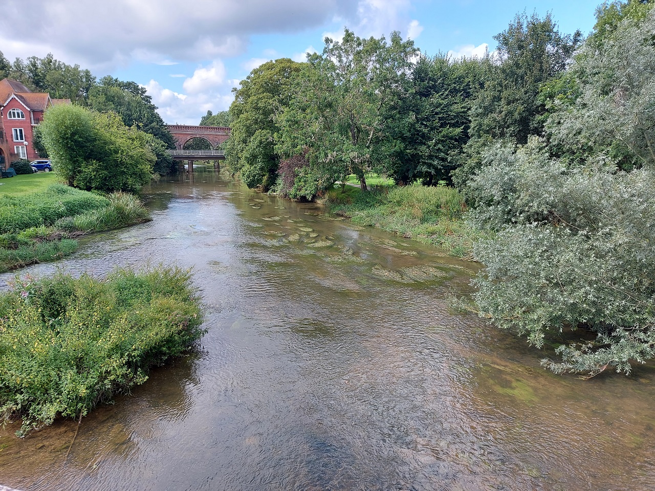
The River Mole at Leatherhead
The catchment of the River Mole covers an area of just over 500km², spread across Surrey and West Sussex. The catchment is largely rural pasture and farmland, but is home to some significant urban areas including Crawley, Reigate, Dorking, and Leatherhead.
The catchment’s main watercourse, the River Mole, rises to the west of the town of Crawley, before flowing for 80km until it joins the River Thames opposite Hampton Court Palace.
Differences in the natural characteristics of the catchment in its upper and lower reaches provide a division into two sub-catchments. The area from the town of Leatherhead down to the confluence with the Thames forms the Lower Mole and Rythe sub-catchment, whereas the area above Leatherhead forms the Upper Mole sub-catchment.
Across its watercourse, the River Mole is joined by numerous tributaries, including the Gatwick Stream, Tilgate Brook, and Baldhorns Brook, to name a few. Although the river largely flows over clay, it carves out spectacular cliffs in the chalk bedrock in the area between Leatherhead and Dorking, also known as the Mole gap.
Challenges include pollution, weirs, flood and drought
A weir at Tilgate is one of many barriers to fish passing along the river
The water bodies that make up the Mole catchment vary in their Water Framework Directive (WFD) classification status from Moderate to Poor, and this reflects the numerous and varied challenges facing the catchment.
The major issue impacting the catchment at large is pollution from waste water sources. The catchment is home to several relatively large towns, so there are a number of sewage treatment facilities present which discharge treated effluent directly into the river, and occasionally also untreated sewage in times of higher than usual rainfall.
The Storymap allows residents to see Thames Water’s live sewage release data. These discharges carry with them excessive nutrients, such as phosphates and nitrates and micro-organisms, which can have a negative impact on the quality of the habitat available for aquatic life such as fish and plants.
The catchment runs primarily over clay. Couple this with the relatively large urban areas and the presence of the UK’s second largest airport (Gatwick) and rain that falls on the catchment very quickly makes its way into the water course, directly from hard surfaces such as roads and runways, or from fields.
This run-off carries with it numerous chemicals and other pollutants which can also degrade the quality of the river habitats available for wildlife. In rural areas, run-off will also carry significant amounts of soil and sediments from fields which can clog up the valuable gravel areas in which aquatic invertebrates like to reside, reducing the food availability for larger organisms such as fish.
Another issue is that fish are also negatively affected by the numerous barriers within the catchment. These barriers are often types of weir – solid structures placed into rivers to alter their level and flow. These physically stop fish from navigating the full extent of the water course. This prevents them from accessing the variety of habitat types that they require to thrive, something particularly harmful to those species such as salmonids and the critically endangered European eel which have complex life cycles that involve migration to and from the ocean.
Parts of the River Mole are prone to low flows
Interestingly, the catchment is prone to both flooding and problematic low flows. Many of the catchment’s waterways have been historically altered to make them more navigable, or to make way for development. This often involves straightening and re-enforcing the river channels, which disconnects the river from their adjacent flood plain.
Disconnection from the flood plain means that during periods of heavy rainfall the water which quickly runs over the catchments clay and concrete into the rivers has no way of escaping the channels, resulting in excessively high water levels and flooding. Conversely, in times of low rainfall, connected flood plains can retain water which slowly makes its way into the watercourses, maintaining flow. A lack of connected floodplains in the catchment means that the Mole and its tributaries often experience low flows during the height of summer, again negatively impacting aquatic life.
Water quality work under way
As the climate becomes more unpredictable it is likely that these issues will occur more frequently or with increased severity. Fortunately, there are steps that we can take to try to avoid this situation, or help the catchment cope.
Partnership members work either individually or together on projects to improve the catchment, but meet on a regular basis to share expertise and experience. The idea is that by working together, groups can pull their knowledge and resources together and agree actions that are right for the whole river (a holistic approach) rather than act in isolation on small sections.
One of the partners, the River Mole River Watch, which is spearheading catchment wide water quality monitoring efforts through their network of volunteers. This initiative will allow the partnership to identify locations which are being particularly impacted by pollution and poor water quality. Armed with this knowledge, catchment partners will then be able to design and implement measures to prevent pollution, or reduce its impact.
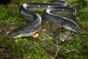
Learn more about our eels project and Crawley focus
European eel image Photo by Darryl Clifton-Day
SERT also works with communities and landowners to identify ways to reduce run-off pollution in urban and rural environments, such as changes in land management practices.
Where reduction of pollution is not possible, SERT is involved in projects to improve river habitat, create backwater refuges and remove barriers so that fish and other aquatic organisms can move into less polluted areas. SERT is also leading on projects to reconnect the waterways of the Mole catchment with their flood plains, providing natural flood management and low flow resilience.
Our work at SERT on the Mole already, among many listed on the Storymap, has included a project to promote and help the critically endangered European eel. During the Thames Catchment Community Eels project – part of wider work on several rivers across the south east – we found twice the number of barriers to eel migration, such as weirs, as had been recorded previously. We also ran workshops and assemblies for 1,136 children and put on other public education sessions, to highlight how this species of fish needs to be able to reach the ocean to complete its life cycle.
We are currently working up our Caring for Crawley’s Rivers project, which will combine river restoration with community engagement such as education in schools and with other groups.
With our newly launched catchment Storymap, you can take a deeper dive into River Mole catchment and the actions that our catchment partners are taking to protect it. You can also find information on opportunities for you to get involved.
Visit our River Mole Storymap, find out about the work to protect and enhance the river and how to get involved!
Have you ever wondered what it’s like to be a Catchment Officer? What is it exactly they do? The South East Rivers Trust’s catchment officer for the Loddon River catchment, Lou Sykes, takes us through a typical week; from admin tasks to going out and assessing the state of sections of rivers with partners, to plan improvements.
Lou says: “My job in its simplest form? I host Catchment Partnerships, meaning I chair meetings of different stakeholders with a geographical common interest in a particular collection of rivers which make up one named network. In my case, one of these is the River Loddon and another the Cuckmere & Pevensey Levels.
“The external partners in a partnership could be water companies, the Environment Agency and Natural England, environmental NGOs, community flood groups, local councils, fishing groups. All of them have an interest in improving the health of the river. Collectively, we want to improve and maintain the health of the river network as a whole, not just treat sections in isolation.
“As detailed on our Catchment Partnerships page, this method is guided by the national Catchment Based Approach (CaBA). Every catchment partnership is different, and this is why they work so well: you can tailor them to your patch and work on the specific needs of that river system.”
Monday
Typically, this is a working from home day. I start with a morning catch up with the Science and Partnerships team before going through my emails. I complete admin tasks such as writing minutes from a Catchment Partnership meeting I hosted recently, then send off a few emails for events and activities planned for later in the week.
Tuesday
Assessing water quality on the River Lyde
Today I was involved producing a statement piece that provides a holistic view on the water quality of the river.
This included information gathering on legal and illegal discharges into rivers, drinking water standard breaches and citizen scientist data collection.
We have been working with local MPs who have a keen interest in their local river and want to work with citizen scientists – members of the public who volunteer for tasks in their spare time.
Through them we want to understand the current state of the water quality and investigate ways that we can monitor and make improvements.
Wednesday
Meeting the catchment partnership members out on site
Catchment Partnership meeting day! These happen quarterly and it was exciting to have our first one in-person, post-COVID. Typically, our meetings have themes – this one focused on looking at emerging water company plans as they go through their next phase of business planning for both their Water Industry National Environment Programme (known as WINEPs) and their Water Resources Management Plans (WRMPs).
Other topics at meetings can vary from looking at biodiversity and wildlife (both native and invasive species) to investigating ideas for tearing up a weir that is acting as a barrier to fish who need to move between different sections of river to find the best feeding and breeding grounds.
By engaging many different parties in this collaborative format, we are providing the opportunity for community groups, government bodies and water companies to come together and form common goals to help rivers thrive. This is particularly important as it allows us to look at the area in a ‘big picture’ format because in every river system, what happens upstream impacts the downstream area.
Thursday
Thursday was spent exploring funding for a potential backwater
This was a strategic day of investigating new funding opportunities that could be available for research, project development and delivery – the on-the-ground restoration work that will improve rivers for wildlife and as places people can enjoy. Being a project-funded organisation means we are constantly looking for funding opportunities. We might be looking to “rewiggle” – or remeander – a straightened river. We might want to help fish connect to different parts of a river network by removing man-made, historical objects such as weirs, as we have done at Acacia Hall, Dartford, or by installing eel or fish passes, like we have done further along the Darent. We might be wanting to look to create backwaters to increase biodiversity and mitigate against potential flooding. For one such example, read about Charvil Meadows, on our Loddon Storymap (in the “Action plan” section under “case studies”).
All this work requires funding, and the co-operation of landowners and other interested groups to make it happen, so the over-riding strategy has to look at prioritisation to improve the whole catchment. On this particular week, I also got out to meet and continue to develop a relationship with one of the key stakeholders on my patch. These meetings are some of the most vital parts of my job. Time and resource in every environmental job is a stretch and collaborative working is the key to keeping everything on track.
I finished off the day with a catch up of our Catchment Officers team at SERT. We are constantly evolving and working out ways that we can work more efficiently, working together so that we are not reinventing the wheel every time something new crops up.
Friday
A large part of my job also involves putting on a pair of wellies, getting out on site and identifying opportunities in the catchment for improving stretches of river or their surrounding land.
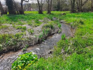
A scene from the Lyde tributary
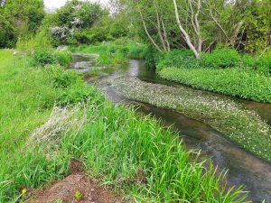
On this particular Friday, I walked three miles up the River Lyde – one of the tributaries of the River Loddon – with members of a local fishing club. They were looking at how they could possibly manage the river for both their fishing club members and to keep the waterway as healthy as possible. This stretch of river is a chalk stream, so we would like the water to be clear, with clean gravel, plenty of underwater plants and a decent buffer of green on the banks. Chalk streams are globally rare habitat with only about 200 of them left in the world, 160 of which are in the UK.
Pleasingly on this day, on this river, a healthy amount of aquatic plant growth was evident and there was a good amount of shade and light getting to the channel. However, it could do with some habitat or restoration work to help mitigate erosions on some stretches.
Not every week looks exactly like this, but this is an average one. There will be weeks where there is more home working, the odd day in our HQ office in Leatherhead in Surrey, or you could end up hosting a week of volunteer events that put you in a pair of waders all week, such as during Loddon Rivers Week held annually in September.
This is the beauty of being a catchment officer or manager – it’s varied nature keeps you on your toes and gives very little opportunity for burn out from doing the same thing over and over again.
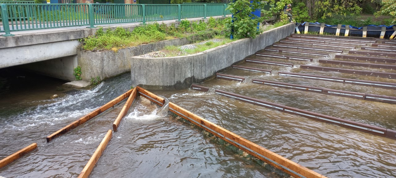
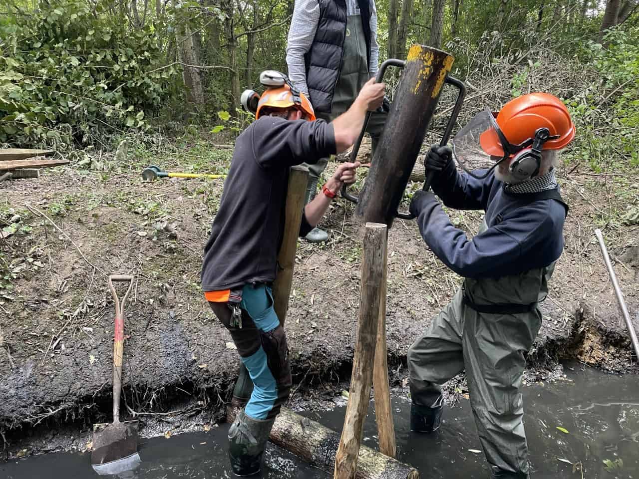
The South East Rivers Trust (SERT) installed a “baffle” fish pass on the weir at the Questor industrial estate in Dartford in late April. Project officer Jack Hogan reports.
Over the past few years, we have been working to improve the lives of fish which need to move up and down the River Darent in Kent.
This began in 2021 when we completed our Acacia Hall River Restoration project in Central Park, Dartford. That project removed a large weir – a barrier to fish moving up and down the waterway – and transformed 600 metres of a silty backwater into a flowing natural river, improving both the ecology and beauty of the park.
The Acacia weir removal also opened up the way for migratory fish to undertake their journeys upstream – and salmon have already been spotted up the river beyond the project.
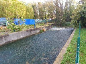
Our latest efforts have been at a weir a little way upstream from Central Park. Known as the “Questor weir”, it was an impassable obstacle for fish. It is long, wide, and gently sloping. This means that, for most of the time, the water that passed down it was just a skinny, shallow sheet in which no fish could have swum.
To help the fish overcome this, we designed, and have now installed, what is known as a baffle fish pass.
A baffle is defined as a device which regulates flow or passage. In this case, essentially it holds back water, becalming it and making it easier for fish to navigate. In doing so, the baffles increase the depth of water on the weir along each line of the section of river.
This results in a series of steps, or a series of rectangular ‘pools’. Breaks in the line of each baffle – known as notches – allow fish to pass between these areas of calmer water, from one ‘pool’ to another. The shapes of the baffles are also designed to reduce turbulence in the water, which helps ease the way upstream for even small fish.
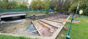
Weir modifications
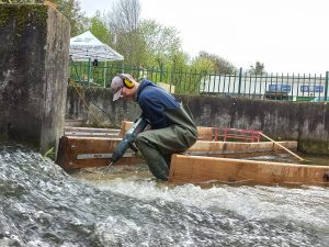
The concrete structure of the weir also had to be modified to allow the fish pass to function properly. At the downstream end, modifications had to be made to the bed of the weir in order for the final three rows of baffles to the installed.
Modifying the weir’s bed to slot the lower baffles into place
At the upstream end, the crest of the weir was also notched. This was done to ensure clear passage through the old steel and concrete crest, and to ensure that enough water flows down through the fish pass. A fish pass without water would be like a ladder without rungs!
What we have installed will be used to pass both up and downstream by everything from baby eels – or elvers – to larger fish such as salmon: and the weir, or rather the newly installed baffles, can serve as their ladder to the next step up the catchment. This work builds on the eel pass that we installed on the Darent in March 2022 and we are currently looking at future projects to further improve fish passage on this river.
SERT is developing other projects on sites all along the Darent which will, step by step, restore and reconnect fragmented habitats across the whole river catchment. Some sections of the river have become “impounded”, meaning they become stand-alone water bodies that are hemmed in by man-made objects such as weirs or dams.
Our video below shows how the flow of this section of river has been dramatically transformed from a rushing, single sheet of water into one that will help the survival of migratory fish.
We would like to thank WL West Sawmill in Petworth, who hand-picked some magnificent pieces of oak from which they cut our beautiful custom baffles for the lower end of the design. The rest of the baffles, made of recycled plastic, were donated by the Environment Agency.
Special thanks must also go to Chris at JLL for facilitating the work. Without cooperation from landowners and managers we couldn’t do good work for nature such as this.
We are also very grateful to everyone at Questor – in particular, the people at Daikin and Kent Powder Coating. They offered us forklift support on demand, saving our backs, and secure overnight storage for our equipment, proving that successful river restoration work always is a collaborative effort by many different groups.
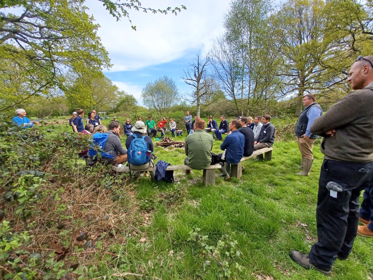
One day in spring, in the middle of the woods of deepest darkest Kent, the South East Rivers Trust led a ‘safari’ to discover the value of nature-based solutions in increasing the resilience of our catchments and communities.
During the past few years, the South East Rivers Trust (SERT) has been developing a series of nature-based solutions for water with landowners in the Upper Beult Farm Cluster in Kent. Nature-based solutions for water (NbS for water) are features that hold back water in the landscape, slowing it down and filtering it so that water resources are replenished and flooding and pollution is reduced. These NbS include leaky woody dams, offline ponds and pasture management.
Explorers from a range of organisations navigated woods, wetlands and farmland to spot and learn about these NbS, covering four farms of the Upper Beult farm cluster.
Firstly, it was to demonstrate how these solutions can underpin water resources provision, as well as achieve nature recovery and other social and environmental benefits.
Secondly, we wanted our guests to imagine what benefits could be achieved if these NbS could be “scaled up”, such as across the whole of the River Medway catchment, of which the Beult is just one part.
Finally, we were keen to spark thought and discussion among our guests about potential partnerships and support that could facilitate this ambition.
The 30-strong party of intrepid NbS explorers were led by Kathi Bauer, SERT’s Senior Natural Capital Officer – and the list of organisations represented was a long one. It included staff from Southern Water, which has supported the development of the NbS with the Upper Beult farming cluster.
Others interested to find out more came from SES Water, the Upper Medway Internal Drainage Board, Water Resources South East, Kent County Council, Kent Wildlife Trust, Waitrose, Linking Environment and Farming (LEAF), the Marden farming cluster, the Forestry Commission and Swale Borough Council.
The safari showcased work that we had initiated through our Interreg2Seas PROWATER project, and further work we have continued with Southern Water’s support. These efforts were the culmination of several years’ work. As we outlined earlier this year, the PROWATER project alone has helped retain more than 60 million litres of water (enough to fill 24 Olympic sized swimming pools) annually.
Kathi explained how we had worked closely with farmers and landowners. She outlined how we had used our expertise to identify, develop and implement appropriate NbS to regulate the flow of water at appropriate locations in the upper catchment of the Beult.
What types of nature-based solutions were explored?
Leaky woody dams were a key solution spotted on the safari: by placing branches and logs across channels and land where water is known to flow, water is held back and “spills” from the channels to create a small wetland. The result is that instead of heavy rainfall running straight off the land, its movement is more gradual. This means its contribution to the flow of the River Beult (an important source for water supply) is spread across many more months of the year.
Holding water in the landscape in this way also means creating richer and more diverse habitat, attracting vegetation, invertebrates and birds that feed on them.
Offline ponds – separated from the river network – were also part of the safari. Offline ponds can be created in natural depressions in the land where water is directed using leaky woody dams. By retaining water, they supplement the Beult’s summer flows and also boost plant and invertebrate biodiversity.
Pasture Management – the benefits of mob grazing were also outlined as part of the safari. If cattle feed on small sections of their grazing land one piece at a time, grass and other vegetation is able to recover and establish. Water soaks into the soil better, with benefits including slowing the run-off of rainwater and pasture that is more resilient to drought.
Together, these nature-based solutions are managing the landscape for water and helping to address water scarcity in the south east, while also providing a range of additional benefits including natural habitat improvements. These solutions are therefore key to reversing the declining trend in biodiversity. According to the Natural History Museum, the world has already gone through the “safe limit for humanity” of biodiversity loss. The UK, its analysis says, has an average of only 53% of its biodiversity left and is in the bottom 10% of countries globally – and last among the G7 countries.
Multiple nature-based solutions all add up, which is central to the Catchment Based Approach (CaBA) principal of managing landscapes as a whole, rather than as separate sections of river or land in isolation.
This is central to our thinking at SERT and something with which those on this NbS Safari agreed: we need to make more of this happen.
For more information and to get in touch about developing nature-based solutions in the landscape, contact Cat Moncrieff, our Head of Water and Land Stewardship. Contact us at info@southeastriverstrust.org or by telephone, on 0845 092 0110.
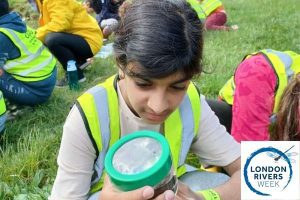
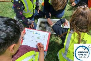
Children aged 5-11 can become official Junior River Rangers for the South East Rivers Trust during London Rivers Week (29th May to 4th June).
Nature scavenger hunts, craft activities and river dipping demonstrations are all part of three interactive sessions packed with family fun that are being put on by the waterways charity.
The sessions will give primary school-aged children the chance to explore and understand the natural world around them and learn about what thrives along popular spots in south London.
Children will learn why rivers are important and pick up water saving tips from SERT’s experienced educators, completing enough “green” and “blue” activities from the charity’s Junior Rivers Rangers scheme to earn a badge and certificate on the day.
The sessions, as follows, are free but must be booked in advance.
30th May 9.30am to 12pm: Discover wildlife by exploring the Beverley Brook in Barnes through crafts and scavenger hunts. Session supported by Barnes Common.
31st May 9.30am to 12pm: Sign up for river dipping and other fun while exploring the River Wandle at the Sutton Ecology Centre, Carshalton. Supported by Sutton Council.
1st June 9.30am to 12pm: Explore the River Wandle with scavenger hunts and a chance to get close to nature at Kimber Skate Park. Supported by Enable at Wandsworth Borough Council.
‘Experiencing nature first hand is key’
Children learn about nature by experiencing it in person
Robyn Shaw, SERT’s Assistant Education Officer who is leading the sessions, said: “Inspiring children to love and value water at the earliest opportunity in life is at the heart of our education programme.
“There’s no better way to understand the types of wildlife that thrives in our rivers than to experience it first hand and to explore it through creating nature art and seeing what is in the river.
“Our popular Junior River Rangers programme also ensures youngsters champion water saving in their homes and gardens. The activities are designed to show them how the water in our rivers is connected to what we use, stirring them to think about climate change, which is a key them of this year’s London Rivers Week.”
London Rivers Week, now in its seventh year, aims to inspire the public to help learn about and protect the capital’s waterways through walks, talks, interactive sessions and seminars.
Focus on climate change
This year’s theme is climate change and how river restoration can reduce its impact, for people and wildlife, through restoring habitats to reduce the effects of extreme weather.
London waterways charity Thames21 is co-ordinating the week, which features more than 30 events spread across the capital. Liz Gyekye, Communications Manager, said: “There’s a very wide range of events for people to get involved with this year, from meandering river walks to craft classes and topical debates.”
Sir Tony Robinson, actor, author and TV presenter, said: “As a devoted admirer of the Thames and its tributaries, I am proud to be supporting London Rivers Week 2023. We need healthy rivers to help us to tackle the negative impacts of the climate crisis.”
* London Rivers Week is run on behalf of the Catchment Partnerships in London (CPiL) via its sister organisation London Rivers Restoration Group (LRRG). The full list of events can be found here.
More than 40 river restoration projects – reinstating a natural process and biodiversity to waterways – have taken place in London since 2000. Since 2000, about 28 miles (45km) has been restored. The principal organisations running London Rivers Week are the Environment Agency, Thames21, the South East Rivers Trust, London Wildlife Trust, ZSL, CPRE London, the Thames Estuary Partnership, and Thames Water.
* The Junior River Rangers scheme is part of the Trust’s educational programme. Education is one of SERT’s mission’s cornerstones. We have a range of initiatives to encourage young people to engage with rivers. Project Kingfisher is our core educational programme covering our South London Rivers (Wandle, Hogsmill and Beverley Brook). For more information visit our education page.
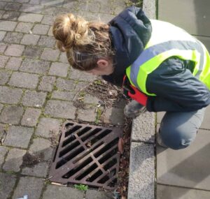
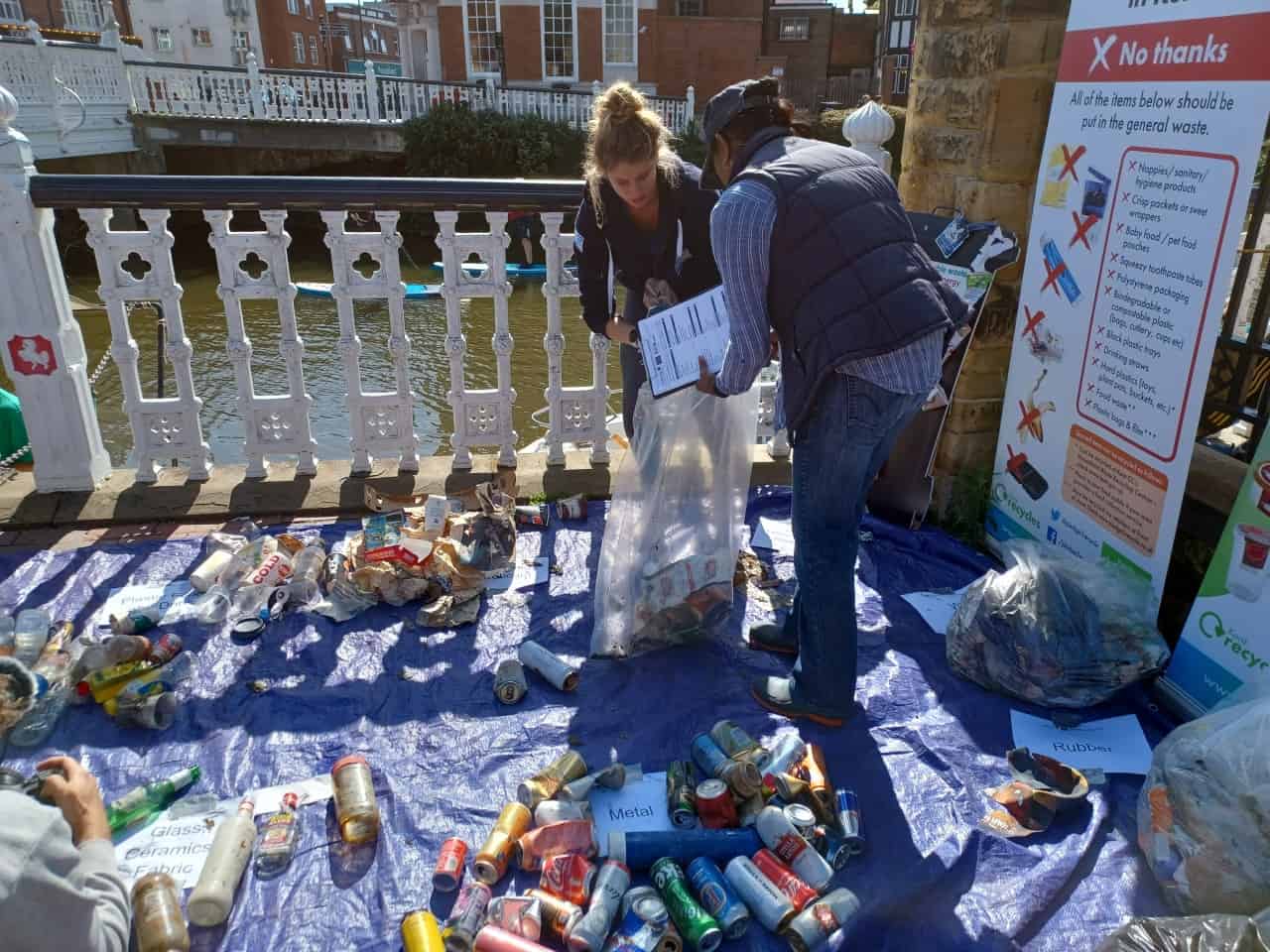
As part of our Preventing Plastic Pollution (PPP) project, the South East Rivers Trust carried out a trial by putting guards under drains in public streets, to collect and assess the types of litter that are ending up in rivers. Hannah Dry, our Plastics Project Officer, reports.
Trialing new ways to prevent plastic pollution
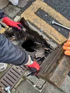
Opening a drain guard to see what litter has been captured
Our work over the past three years for the Preventing Plastic Pollution project has involved many cleanups and litter categorising events, education sessions and workshops and setting up a River Guardians scheme.
These were to make the public aware of the problems caused by plastic in rivers and oceans and to help communities think about how they might reduce their reliance on single-use items, which accounts for 50% of the of the plastic that reaches oceans via rivers.
Another principal aim of PPP, however, was to investigate and trial innovative ways to prevent plastic reaching rivers in the first place.
One way in which we did this on the River Medway, our section of the 18-partner PPP project, was to trial the use of drain guards on public streets. What goes down these public drains goes straight into the river. The idea was to capture litter, to see what types were common and to examine the scheme’s potential – if scaled up – to preventing litter reaching rivers.
We worked in partnership with Kent County Council to put in six drain guards around Maidstone town centre, installing them for a nine-month trial.
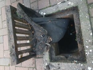
The problem with drains
Monitoring took place regularly during the nine-month trial
Drainage pipe networks are complex. Ownership is fragmented between different organisations such as local authorities, water companies, internal drainage boards, highways authorities, businesses and private individuals. These bodies only maintain the drain, but the responsibility of preventing pollution sits with no one.
What we do know is that rainwater drainage systems are a source of pollution directly into rivers – and a lot of this pollution is plastic. Once in the river, it is difficult to remove, resulting in immense damage to the environment, organisms and affecting water quality – and finally ending in marine ecosystems.
Last June, we installed drain guards to capture the debris, not just to prevent it reaching the river network but giving us the chance to see what types of litter were common.
The guards – which were nicknamed witches’ hats because of their triangular shape – are made from a geotextile material and designed to sit beneath a drain grill to act as a filter, catching plastic litter and debris that are washed in through runoff.
Monitoring these drain guards every few months, we found that we had to fit new models in three of the drains after four months because of issues with cigarette burn holes. Emptying and categorisation of the litter occurred at every monitoring session throughout the trial. The purpose of the trial was to assess the feasibility and effectiveness of the drain guards in preventing litter getting into the drainage network and to assess their potential to provide a long-term solution for stopping plastic pollution from point source discharge outlets into the Medway.
What we found
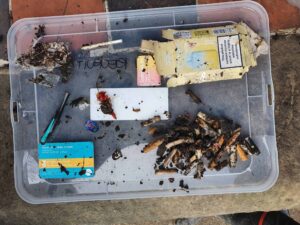
Cigarette butts were the most common find when emptying drain guards during our trial
There is no doubt that plastic litter falls into our drainage networks from roads and pedestrian walkways. Plastic was found in every drain guard during every monitoring session. Over the course of the trial, the guards caught and removed more than 774 items.
The locations to trial the drain guards were chosen based on the footfall and on their proximity to amenities such as bar and pubs. That was exactly where we found the highest volume of litter, the biggest number of cigarette butts and bits of rubbish that can be directly linked to the consumer – such as lemon slices, plastic straws, and beer bottle lids.
This gave us the chance to assess the influence of amenities with the volume of litter in the drain as well as giving an opportunity to engage with passers by on site and to use the information later on to engage directly with pub/bar goers and owners.
The most frequent litter type, by far, was cigarette butts (423). Their filters are made from a chemical compound – usually cellulose acetate, a type of synthetic fibre. It takes years to break down.
The next most common item that we found were unidentifiable plastic items (172). These were too small to be categorised or too degraded, having been out in the environment too long. The strangest things we found were half a toothbrush handle and metal magnetic balls.
We also found 74 pieces of used chewing gum. It is common for chewing gum to contain plastic polymers such as polyvinyl acetate, which gives chewing gum its elasticity. Again, this means it will take a very long time to break down.
The items we found in the guards varied drastically between locations. Bottle tops, cigarette butts, straws and were all found in the guards outside pubs, whereas the guards placed on the high street next to shops typically collected items such as receipts and sweet wrappers.
Is there potential for scaling up?
Hannah before opening a drain guard
The theory behind installing drain guards is sound – stopping pollutants before they become an issue for river ecosystems. However, the wider use of drain guards still, arguably, addresses the symptom rather than the cause of plastic pollution.
Consistent categorisation of litter during every emptying of drain guards is unrealistic, as it is time consuming and requires multiple people. Therefore, it is likely they would only be used to prevent plastic debris from entering river catchments. Yet this is still a very valuable function and something that we as a society must consider if we are to have any effect on the amount of plastic entering our rivers.
The complex nature of drain ownership and tailoring the size and shape to different sized drains, to ensure litter is collected more reliably, are also challenges that would need to be overcome.
And then there was the glamour factor…
This trial was not a glamorous one. A lot of the time was spent inspecting drains and counting very degraded and contaminated piece of litter that many people would find very disgusting. Not to mention the smell of the drains! Imagine sewers.
Yet it is necessary. Only by counting and categorising what we find down these drains can we then begin to understand the type and scale of the items and begin to think of ways to prevent it getting there in the first place.
There is too much plastic flowing into our rivers. Once it finds its way into a river, it is very difficult to remove. We need all stakeholders to take responsibility for the drainage networks and monitor and stop what is falling into them.
This trial provided data about what is entering the drainage network and how this differs between locations. It has tested different technologies to address this issue and highlighted areas where it could be feasible long term.
The launch of our River Loddon Storymap, on behalf of the catchment partnership, allows residents across the area to see the problems faced by the river and the collective actions of around 20 partners in trying to improve the waterways. Residents can also sign up to join in, as individuals or to join the partnership as a group. Lou Sykes, catchment officer for the Loddon, introduces the new Storymap.
Capturing the work of catchments
The Whitewater, a tributary of the Loddon
Since its inception in 2000 as the Wandle Trust working on one river, the South East Rivers Trust (SERT) has grown exponentially and now cares for and maintains watercourses across 12 catchments in the south east of England.
SERT is also long established in the Beverley Brook and Hogsmill catchments, hosting and chairing the catchment partnerships. These lead a variety of organisations to devise ways to assess the issues faced by rivers and create plans to improve them using the Catchment Based Approach (CaBA).
Our growth is such that we now partially or fully host and chair 11 of the 12 catchment partnerships throughout the south east. This area stretches from the Kent coast to the Sussex coast, meandering through Surrey and encompassing much of Berkshire and north Hampshire.
It is for this latter area, the 680 km2 River Loddon catchment, that SERT has now launched a Storymap, capturing the partners, issues and plans to improve the whole network of watercourses. This will be the first in a series of new Storymaps on various catchments that will be released in 2023, funded by Thames Water.
The ArcGIS Storymap portal is a story authoring, web-based application, that enables an organisation to share maps in the context of narrative text and other multimedia content.
Using this facility, SERT’s catchment partnerships can detail the pressures faced by the river networks and introduce objectives for improving rivers and the surrounding areas, as identified by the partnership.
Bringing different groups together to solve the river’s issues
A scene from the Lyde tributary
By creating this presence online, the catchment partnership raises awareness and becomes a supportive group, speaking with one voice. In the case of the Loddon catchment, this brings about 20 different groups together: this better empowers collaborative working and helps to ensure all issues affecting the river are noted, captured and addressed under one umbrella. By working together, the catchment partnership can plan and deliver positive actions that will improve the riparian environment across a whole river network, as opposed to working on sections in isolation.
Leading on the Loddon catchment partnership, SERT brings together people from various local organisations and interest groups including water companies, government bodies, local flood groups and angling clubs.
Giving communities and groups the chance to have their voices heard is crucial to the Catchment Based Approach, empowering them with a sense of ownership as the partnership delivers action on the ground.
Summaries of issues affecting the river range from the general to the specific, such as under water quality. Did you know, for example, that road runoff can carry more than 300 different pollutants which can cause short and long-term damage to watercourses?
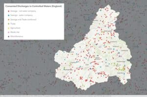
Consented discharges on the Loddon
Meanwhile, one of many bespoke maps details the phosphate status of the river network, which rises from chalk-fed streams in Basingstoke and goes all the way to Reading and stretches across to Aldershot. Another map shows the pollution from waste water. Another details the topical issue of sewage spillages.
The extend to which the catchment is affected by flooding, low flows and abstraction is also outlined, with a warning: “The primary risk of flooding in the Loddon catchment is from rivers – and flooding events are being projected to become more frequent and more severe as the climate changes.”
Flood zones and areas most susceptible to flooding, from both rivers and surface water, are shown in another map.
The site also reports the extent to which physical modifications have impacted river health. Like many rivers, the Loddon has been modified over centuries – straightened, widened or deepened – to improve drainage for land, housing, industry and farming.
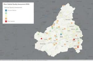
Habitat quality on the Loddon
River habitat quality is also shown, with just one area rated as having a truly diverse habitat, according to River Habitat Survey methods. Many areas across the catchment have good ranges of habitat, but others are rated as poor. Another map outlines the results of fish surveys, compiled as indications of river health, allowing readers to click on specific areas.
The issues section ends with a warning: “The number of people living in Basingstoke, Wokingham, Sandhurst, Fleet and Aldershot is rapidly growing and these towns have multiple areas of new development proposed between 2023-2040.
“The south east of England is in the midst of a water shortage crisis. Growing populations together with our changing climate pose a severe risk to the health of our rivers. Many of the challenges faced by our river catchments are likely to be intensified by the demands of a growing population.“
So what can be done?
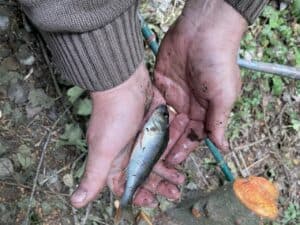
Perch found at Tice’s Meadow in Loddon Rivers Week 2022
A key section of the Storymap is the action plan, outlining “natural processes opportunity mapping” that includes the potential for “floodplain reconnection”, for example lowering artificially incised riverbanks, the potential for riverside woodlands and such opportunities across the wider catchment.
Key priorities are to identify habitat improvements, deliver restoration or enhancements, improve fish passage by tackling barriers, keep rivers cool in the face of a changing climate and tackling invasive species.
It also outlines the benefit of natural capital mapping. “Taking a GIS-based catchment approach to understanding the location, condition and potential of natural assets,” the portal says “allows us to target action to protect water resources and communicate change. This enables us to integrate a catchment-scale nature-based solutions approach with water company plans, catchment partnerships, and landowners.”
Mentioning work that has been carried out on the catchment so far, the portal highlights Loddon Rivers Week, which takes place every September. Last year, residents witnessed instant improvements after taking part in gravel seeding in Hook and installed large woody materials at Tice’s Meadow and Ivy Recreation Ground in Aldershot. Other work on the Loddon involves a long-standing effort to remove Floating Pennywort and creation of the Charvil Meadows backwater in 2020.
Lastly, the Get Involved section prompts people who see issues with their river to report them to the relevant authority, to suggest enhancement protects, join the partnership as a group, volunteer for events or invest in the river by financially supporting enhancement work.
Whatever you want to know about the Loddon, visit the Storymap and get involved!
Have you ever looked outside a train window and wondered what it is you are passing, or thought about the history of the towns and the landscape around you?
Learning about the subjects that feature along your journey is exactly what you can now do on a rail journey between London Waterloo and Southampton, thanks to an App called Window Seater, launched today.
Tales of how the River Mole might have got its name, the lifecycle of the endangered European eel and what makes London’s chalk streams globally special now feature on the Window Seater app, which invited the South East Rivers Trust (SERT) to talk about rivers that passengers will pass.
Window Seater interviewed Polly Penn, SERT’s Head of our Working with Communities, to gather insight for an audio story on London’s chalk rivers.
Fascinating histories of art, culture – and rivers
Polly Penn’s audio on Window Seater captures the essence of river life outside the train window. Picture by Adam Borkowski Pexels
The Wandle, Hogsmill and Mole rivers criss-cross under the railway and feature among 11 stories that listeners can enjoy between Waterloo and Southampton.
Passengers who have downloaded Window Seater are notified as they pass points of interest on their journey, from art, culture and community to history and geography.
You can hear about links to author Jane Austen and fictional spy James Bond, plus Woking’s alien invasion and Britain’s first ever car journey, or pioneering women in motorsport, alongside Polly inspiring you to explore rivers and pathways along them.
The concept for Window Seater was born by Pete Silvester, who – living in Paris at the time – began talking to an old man, a regular on one particular route. This companion started telling him about all the places and histories they were passing.
How fascinating would it be to act as a guide along rail routes around the world, Pete thought?
Meeting like-minded, story-loving travellers Marcus Allender and Richard Edwards in Myanmar (Burma) in south east Asia in 2016, the trio went on to develop Pete’s fledgling concept of Window Seater.
Now, it has been taken on board by South Western Railway.
Inspiring listeners about eels and river walks
Polly gives a commentary about the River Wandle, The River Mole and the Hogsmill River, which all feature along the route.
Eel monitoring by the South East Rivers Trust happens along the route. Picture by SERT
She explains that where the train passes the Mole near Hersham, this is close to where SERT has a monitoring station for the European Eel as part of a project to help protect this critically endangered species.
Polly further explains the surprising lifecycle of this fish and how her perceptions of eels shaped her views before she moved from the countryside to London.
Her commentary outlines the ability to reconnect with nature via rivers, waterways being spaces where you can unwind and relax, telling listeners that they can walk right along the Wandle or Hogsmill and mentions points where the river intersects with the rail network.
A spokesman for Window Seater said: “At first glance from the train window, south west London suburbia doesn’t shout intrigue – but when we looked a bit harder and saw the little rivers that criss-cross under the railway we knew there had to be a story there.
“It was a delight to collaborate with the South East Rivers Trust and to get Polly’s personal insight into this fascinating part of London’s geography and ecology.”
So next time you are on a train from Waterloo towards Southampton, why not download the free Window Seater App from Apple or Android stores and listen to this tale of our rivers as your train passes through the rolling countryside?
On World Water Day, Dr Sam Hughes highlights our Holistic Water for Horticulture project, working with growers to make the most of every drop of water in the face of a changing climate which is likely to bring more droughts.
Last summer’s brutal drought was a stark indication that we are entering a “new normal” of hotter summers, milder wet winters and more frequent extreme weather events, from dry spells to intense rainfall.
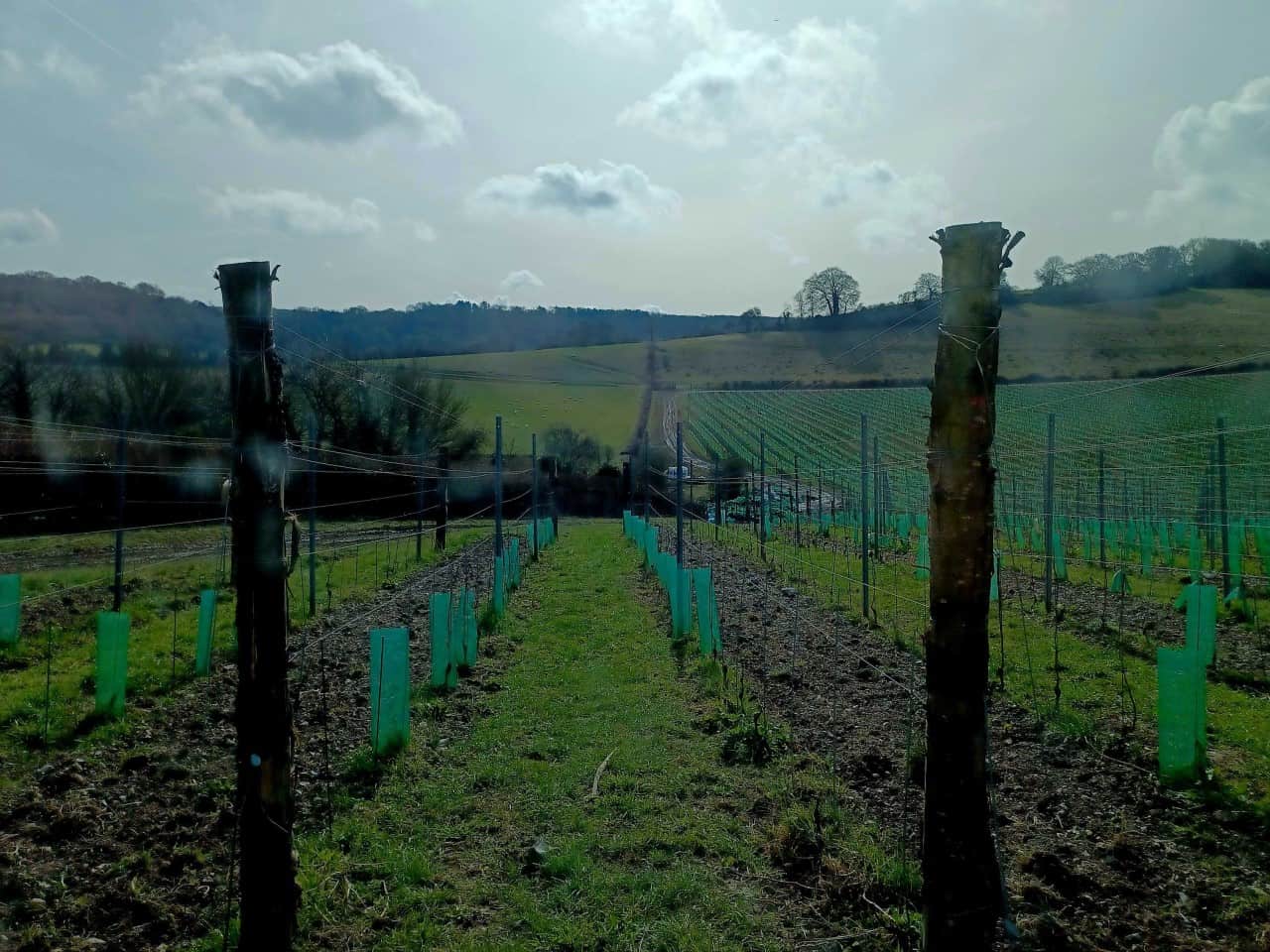
Vineyards are among large-scale crop growing that requires huge amounts of water
Climate change is real. Temperatures reached 40C for the first time in England last year. The south and east of England had the driest July on record. Rivers ran low. Wildlife, people and businesses all suffered.
The message for tackling the climate crisis from the Rivers Trust at the time was clear. We need: a faster, more coordinated government response to extreme weather impacts; investment in water infrastructure to reduce leakage; clear support and guidance on measures to reduce household consumption; and the need to build back wetter.
“For the coming year and… for the coming decade, a complete gear change is needed for how water companies and all water users, from farmers to households, think about how they use water and understand its fundamental value.”
A wet winter, comprising five consecutive months of above average rainfall, might have lulled some into a sense of security in the short term. However, the driest February for 30 years has been a rude awakening to 2023, bringing the possibility of another period of drought for a horticulture sector in crisis, in a region of the country already classed as water stressed.
Working for water resilience, food security and environment
Water is the foundation of the horticulture sector and this is keenly felt in the drier, more crowded catchments of the South East, where lots of water is needed for a long time by a lot of farms.
Precision irrigation for crops is required to ensure the best use of precious water resources
High value protected edible crops (soft fruit, tomatoes, peppers and cucumbers to name a few) require precision irrigation over a long growing season. Out in the open, newly planted fruit orchards should be irrigated to allow young trees to establish, thrive and produce crops to support and expand business.
During the 2022 drought, a lot of growers scaled back crop areas, which ultimately affects consumers through limited availability. Many supplemented irrigation with mains water, an expensive commodity that further eroded shrinking profit margins already squeezed by inflation, labour shortages, higher labour costs and inflexible supply contracts.
Is it any surprise that these circumstances have resulted in contraction across all UK food production sectors?
Innocuous terms like “scale back” and “contraction” belie the extreme hardship being felt by businesses across the sector, especially smaller ones. The vulnerability of domestic food security has been laid bare, set against a landscape of highly altered sourcing catchments unable to cope with climate change impacts. Without acting collectively in order to drive change to lessen such impacts, businesses, supply chains, communities and the natural environment will ultimately fail.
The Courtauld 2030 Water Roadmap was launched by WRAP, the Rivers Trust and the World Wildlife Fund to meet “the challenges we face in protecting critical water resources for food supply, for nature, and for local communities” in key sourcing catchments across the UK and abroad.
The Roadmap target is for 50% of the UK’s fresh food to be sourced from areas with sustainable water management by 2030.
The South East Rivers Trust (SERT) is keenly aware of the pressures the region’s horticulture sector faces to balance water resilience, food security and environmental needs while staying in business, through our work with the Holistic Water for Horticulture project (HWH), a Courtauld 2030 Water Roadmap project. This promotes a collective approach to water and land stewardship.
The answer to being able to respond to the impact of dry spells lies in how we capture, retain and use water from our wet periods.
The pathway to water resilience is clear:
we need to build back better and wetter
it is better to work together and proactively to reap bigger water resilience benefits
Helping landowners avoid drought
HWH uses remote data to map and identify areas of present and future water risk in the South East. This high level approach is vital for targeting engagement in high risk areas, to raise awareness of the challenges that growers and neighbouring landowners might face if droughts became a “business as usual” scenario.
HWH staff make site visits to discuss water challenges and potential site-tailored solutions that can, in some cases, bring multiple benefits.
Winter and high flows from rivers and rainfall from rooftops and polytunnels should be captured and stored for irrigation. Currently, rainwater from buildings and polytunnels can be harvested without a water abstraction licence, reducing dependence on expensive mains and diversifying water resources that support business resilience and growth.
Still a relatively new concept, water trading and sharing between water abstractors across a given area will result in a more dynamic water management landscape.
Nature-based solutions such as wetlands, scrapes, planting native flowers, shrubs and trees in areas that are prone to flooding can provide alternative sources of income (carbon credits, biodiversity net gain, stewardship schemes) to growers alongside cropping areas.
Wetlands and scrapes provide advantages to land owners
These measures benefit both nature and neighbours by slowing the flow from extreme rainfall events, mitigating flood and reducing soil erosion and damage to property.
Elsewhere across SERT’s work, we work to retain water in the landscape through projects such as PROWATER, one of 10 pilots supported by the Interreg 2 Seas European Regional Development Fund.
Working together instead of in isolation to address the many challenges that face the sector packs more of a punch. Farm clusters, producer organisations, cooperatives and abstractor groups can be powerful lobbies that share information and drive change across the sector.
These are the motors of change – for water resource management and large-scale delivery of measures, such as Landscape Recovery projects through Environmental Land Management Schemes (ELMS), that benefit growers.
By joining forces with environmental experts at SERT through projects like HWH and PROWATER, these powerful groups can identify, develop and deliver solutions and make connections with different water users and stakeholders across the catchment prepared to invest in measures and innovation that benefit them too.
Are you a farmer or grower who would like advice on water resilience and management issues? Fill in our request form to book a visit from our experts.
As our PROWATER project comes to an end, Kathi Bauer, our Senior Natural Capital Officer, reports on the importance of working together using nature-based solutions to retain water in the landscape, protecting rivers and communities from the effects of climate change.
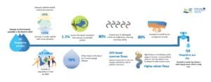
The results of our work, carried out over the past four years, will help retain 24 Olympic sized swimming pools worth of water in the catchment each year – and that’s just on a small section of the landscape.
Water scarcity is an issue we need to address now
Back in 2018, when PROWATER first started, a summer drought was putting pressure on water resources and nature. Then, we thought this was a timely reminder of how vulnerable our freshwater systems are to climate change and the need to address this challenge for people and wildlife.
Little did we know that, four years later, we would experience the driest July in England since 1935, with temperatures reaching 40°C for the first time. Almost the entire country had hosepipe bans imposed. Many rivers recorded the lowest flows ever seen – and it was even reported that the source of the Thames dried up.
River flows on the Beult at Stilebridge, at the bottom of the catchment, for five historic droughts and the year 2022. Some of the lowest flows ever were in 2022 (black line).
PROWATER – Protecting and Restoring Raw Water Sources Through Actions at the Landscape Scale – set out to demonstrate how nature-based solutions (NbS) can replenish water resources at a catchment scale. These NbS included wetland restoration and changes to rural land management.
In the four years since the project started, the South East Rivers Trust has worked with:
three water companies
24 farmers
It has delivered:
2 headwater wetland restoration sites
16 hectares of improved soil management
supported 8.4 ha of chalk grassland and heathland restoration
Together, these measures will help retain more than 60 million litres of water (enough to fill 24 Olympic sized swimming pools) in the catchments every year through slower release to the river and improved recharge to the groundwater aquifers.
The 2022 drought proved a valuable stress test for these measures, but also brought home the crucial importance of scaling up our efforts to restore catchments in order to protect rivers, wildlife, and our own need for water.
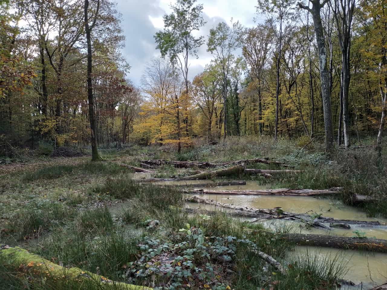
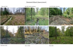
The restored headwater wetland at Streetend Wood, Moat Farm pictured in November 2022
Finding the right solutions for our catchments
As with any restoration effort, a key question was how this work could be funded. Public funding – mainly through agri-environment schemes – was set to change after Brexit, while private markets were only just starting to investigate how natural capital should sit alongside their regular balance sheets.
We worked in partnership with others to develop an evidenced base and demonstration site in the following areas
Friston Forest, part of the Eastbourne Chalk aquifer in the Cuckmere catchment and a focus area for project partner South East Water where chalk grassland and chalk heathland were restored
The Little Stour, where we supported Kent County Council and the Kentish Stour Countryside Partnership to improve soil health of farms. By doing this, we enhanced water replenishment of the chalk aquifer that feeds this chalk stream. This work included using cover and companion crops and an innovative rotational grazing trial on a stud farm.
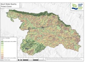
We in particular focused on the River Beult, a tributary of the Medway, which feeds an important abstraction point supplying Bewl Water. This in turn provides water to large areas of Kent. The River Beult is a Site of Special Scientific Interest (SSSI) – the only riverine SSSI in Kent – but is heavily degraded because of historic modifications, including drainage and dredging. Less than 5% of its area remains as wetland habitat – an important natural feature that would have been historically much more common.
The resilience of water supply in the Beult catchment and beyond is affected by a number of factors, including the presence and condition of habitats like wetlands across the catchment.
Working together to demonstrate how nature-based solutions can be delivered
Using mapping methods developed in PROWATER, we were able to target locations of potential headwater wetland areas, which, once restored, would help the river hold on to water for longer over the course of a year. Kent Wildlife Trust’s Upper Beult Farm Cluster officer helped us contact relevant landowners, leading us to visit Moat Farm, in the headwaters of the catchment, and Pullen Barn Farm, at the start of the High Halden tributary to the Upper Beult. On Pullen Barn Farm, we worked with owner Hugh Richards to trial introducing more species-rich pastures in his livestock system, as reported on a previous blog.
Moat Farm proved to be the perfect demonstration site for a new approach to restoration, focusing on process-based interventions with natural materials from the site. Landowners Mike and Jan Bax were crucial enablers, sharing our vision for the site: to demonstrate how wetland and stream restoration could look in the Upper Beult and make it a viable option for farmers and landowners.
The multi-year nature of the project allowed us to understand the opportunities on the site and build a strong relationship with Mike and Jan, and also the wider farmer cluster, facilitated by the welcoming partnership approach Kent Wildlife Trust took.
At Streetend Wood, one of two wetland restoration sites on Moat Farm, work started in February 2021. We took down some trees, before bird nesting season, to use as material for delivery of the main works in July. In November 2021, the site started wetting up before entering a long, dry period. However, throughout the drought, vegetation stayed lush and some standing water was present until September 2022, providing refuge for wildlife.
The timeline showing work at Streetend Wood, Moat Farm
From demonstration site to catchment-scale restoration
While we are really proud of what we have delivered here, we know it is nowhere near enough. Our catchment-focused natural capital mapping, building on the WaterSystem Maps developed by the University of Antwerp, has helped us identify 5,000 ha of potential wetland habitats in headwaters and along the stream network in the Beult alone. If we really want to make a difference to our rivers, then we urgently need to grab hold of these opportunities.
A map showing the contribution that natural habitats across the catchment make to protecting water quality in the Beult. Ⓒ South East Rivers Trust
So, how do we make this happen?
The answer, really, is simple: money. Most landowners will not be willing to engage with environmental schemes that have a detrimental impact on their business. While there are a number of positive, valuable options available under existing and new stewardship schemes that support farming with nature, we must go further than cover crops and two metre buffer strips.
We want to deliver on the vision of the Beult that we built over the course of the last few years and create a wetter, wilder and more diverse landscape where the river has space to thrive. We are also helping communities by slowing release of water into the river, from which water supply for the area is abstracted.
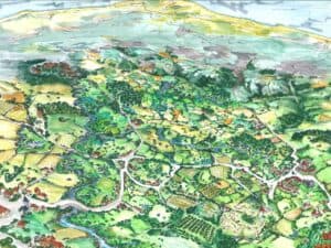
A vision of the Upper Beult catchment as we’d like to see it – a meandering river with functioning floodplains full of a mosaic of wet grassland and wetland habitats, wet woodlands in headwater catchments, thriving farms with hedgerows, ponds and healthy soils protected by vegetation all year round.
This comes with uncertainty, long-term land use change and unknown costs and activities that need to be built into schemes. We know that public funding can’t deliver on ambitions like this fully. The Green Finance Institute’s Finance Gap for Nature Report estimated that in order to deliver on the targets set by government, for example, we have a gap of £8bn funding committed to reach clean water-related targets alone.
Pilots show value for further funding
Our PROWATER Test & Trial, a sub-project of PROWATER delivered as part of Defra’s work to investigate how future government funded agri-environment schemes can support landscape-scale nature recovery, looked at how we could set payment rates that worked for farmers, and combine private funding (such as from water companies) with public money.
One barrier is the way that water company funding is regulated and its five-year cycle, among other issues. On a regional scale, for example, very few nature-based and catchment options have made it into the regional water resource plan. This is partly because of how difficult it is to model and quantify the cost-benefits of NbS on water supply.
Key to unlocking this will be piloting schemes at a larger scale and developing a shared ambition and understanding of drivers and barriers within the water industry. Then, using these schemes to develop new approaches to assessing, valuing, and integrating nature-based and catchment options into water company business plans.
Workshops helped bring together different water companies, regulators, conservation organisations and landowners.
In the Beult, we are now building on our work in PROWATER through a Natural Environment Investment Readiness Fund as well as a partnership with Southern Water and the Upper Beult Farmer Cluster, funded through Southern Water’s Environmental Improvement Fund.
The future: Co-designing landscape-scale schemes
Building on the work at Moat Farm, we are working with nearby landowners to co-develop a plan to restore and protect 18ha of riparian and headwater wetlands along 2.5km of the Upper Beult.
Further afield, across other catchments in the south east, we are using the mapping developed as part of PROWATER to understand the natural assets in the catchment, how they contribute to resilient water supply, and where opportunities are for restoration. Developing this with water company partners (Southern Water and Affinity Water), we are building a shared evidence base of these habitat features and why they are important to protect. This will help us – and them – make decisions about how and where to invest funding and to understand the scale of investment needed and impact possible.
A crucial component is developing payment schemes for landowners that reflect the benefit they are providing to the water company and enable us to deliver value for money to both. There are a lot of challenges, but the most exciting and promising part of this project is that everyone involved sees the opportunity it offers and treats it as a way of learning how we can make this work – together.
PROWATER was funded through the European Regional Development Fund, with additional support from Southern Water, South East Water, Kent County Council, Defra and the Patsy Wood Trust.
A former senior partner in a major multinational environment consultancy, Steve Laking, has been appointed as the new Chair of Trustees at the South East Rivers Trust. He is one of five new Board members.
Steve has worked in the environment and water consulting sector for 35 years, including holding a number of executive roles as a senior partner at ERM, the world’s largest pure sustainability consultancy and, more recently, at Ramboll Environment and Health, where he served as the Divisional President for Europe, the Middle East and Africa (EMEA).
Steve Laking, the new Chair of the Board of the South East Rivers Trust
Steve has conducted projects in groundwater resources and quality in the UK and abroad. His first was on the Channel Tunnel, determining the origin of groundwater inflows in the early phases of construction.
More recently, he has been motivated to “give something back” and qualified as a geography teacher. Additionally, he is also responsible for a small Trust, supporting the education and welfare of children in an orphanage in Kuala Lumpur, Malaysia.
Steve says: “I am honoured and delighted to have been appointed as the Chair of the South East Rivers Trust. I recognise the amazing work that the Trust does across the region in addressing the crisis that our river ecosystems are currently facing. The scale of the responsibility is significant globally; with 82% of the world’s chalk river ecosystems lying within our footprint, we have a major responsibility to restore and sustain the vibrancy and diversity of our rivers.
“I am excited about working with the Trust for a number of reasons, not least the opportunity to work with a fantastic and committed team – and the chance to make an even bigger difference to our river catchments in the south east. I am confident that we will rise to the challenge.”
New Board members have a wide range of skills
Joining Steve on the Board are four other new colleagues: Jennifer Collins, Jeff Andrews, Michael Parker and Victoria Finney, who bring a wealth of knowledge, skills and experience.
Jenny Collins
Jenny Collins is a Principal Geomorphologist in the Sustainable Water Management Team at WSP, one of the world’s leading engineering professional services firms. Her team specialises in river restoration, biodiversity net gain (BNG), sustainable sediment management, catchment management and the Water Framework Directive (WFD). She has a particular interest in delivering river enhancements and working with natural processes.
Jenny, who has a PhD in river restoration monitoring, has experience of identifying and assessing environmental impacts on the water environment and designing appropriate mitigation or environmental enhancements where required.
Jenny has been proactively working in partnership with other consultants to develop national Chartered Institute of Ecology and Environmental Management (CIEEM) training on the implementation of the rivers and streams metric for BNG. She has been exploring the credit process with rivers trusts and is keen to help SERT to maximise the benefit from BNG funding sources.
Jenny says: “I am genuinely excited to be joining the Board of SERT and to be working with their brilliant team. I applied to join the Board because I was inspired by the fantastic benefits that they deliver for our rivers and catchments. I can’t wait to be a part of it!”
Wandle and Thames connections inspire desire to help
Jeff Andrews
Local interest drew asset manager Jeff Andrews to apply to join the SERT Board.
Jeff says: “I am honoured to join the SERT Board after living next to the River Wandle for more than 20 years and having followed the progress and even participated in the extraordinary projects of the Trust.
“I hope to be able to bring my strategic planning, project management and operations management skills to bear to help SERT prosper.”
Jeff has more than 25 years’ experience in the asset management and technology sector (including NASA) and applies the strategic planning, operations and project management, technology and people skills gained to help organisations prosper.
Michael Parker
Michael Parker, a retired solicitor at a law firm in central London, has spent a decade as a trustee of a disability charity in Kingston, including a spell as Company Secretary.
Michael has lived beside the River Thames for nearly 30 years and is “acutely conscious” of the value and beauty of our rivers and the need for organisations such as SERT to preserve, protect and enhance them now and in the future.
Michael says: “I am honoured and excited to join the Board of the South East Rivers Trust at a time when the health of the nation’s rivers is both at risk and in the public eye as never before.
“I believe the work that all rivers trusts carry out is vital to the future of the environment and needs to be supported in any way we can.
“The coming years are critical to their future and I am happy to do anything I can to assist.”
Victoria Finney
Victoria Finney works as a consultant providing advice to CEOs, Boards and executive teams on governance, strategy and organisational change, as well as leading board evaluations. She has a background in strategy, analysis and governance and has worked for more than 20 years at the centre of major public service and private organisations as well as charities in chief of staff and company secretary roles.
Victoria says: “Improving the health of our rivers is critical and I am delighted to be joining SERT and bringing my experience of working with charity boards and management teams to support this vital work.”
The new appointments bring the number of SERT Trustees to 10. The other Board members are: Dave Brown (vice-chair), Alex Dawtrey, Gideon Reeve, Michael Doble and Martin Hurst.
Every five years, water companies in England are required to produce a Water Resources Management Plan (WRMP), which outlines how they intend to meet the expected water demands not just in the next five years but over the next 50 in their respective service areas.
These plans take into account increasing population, climate change and growing risks of drought – while also protecting and enhancing the local environment.
An important part of the WRMP plans is customer feedback on topics which concern them most. They are currently in draft form and out for public consultation.
Do you see drains – known as outfalls – spilling pollution into rivers when out on riverside walks? Do you know why this happens and would you like to help sort out the problem?
Our rivers should be healthy spaces for wildlife, but need protecting from many forms of pollution. One of them is household plumbing that is misconnected, meaning that foul water goes straight into the waterways through drains that should be connected to the sewage system.
This spring, river lovers along the Wandle and the Cray and Shuttle are being given the chance to train as citizen scientists to help rectify the problem in the latest roll out of the Outfall Safari programme.
To paraphrase Monty Python’s Life of Brian, what have sea trout ever done for us? They haven’t built any aqueducts, roads or made any wine…. but scientific research has demonstrated just how important they are in maintaining freshwater resident brown trout populations.
Enabling migratory sea trout to return to their spawning areas is just one reason freshwater conservationists work to improve fish passage and the ecological connectivity of rivers.
The South East Rivers Trust’s head of Science and Partnerships, Dr Chris Gardner, illustrates below an example of the trout to underline the importance of overcoming barriers to fish migration.
In an effort to improve the environment we live in, Preventing Plastic Pollution, one of SERT’s ambitious primary projects, focuses on reducing single-use plastic on the River Medway as part of a much wider effort across both France and England.
At this festive time of year, being aware of reducing our plastic waste is something everyone can – and should – take a moment to think about.
We asked staff at the South East Rivers Trust for their ideas and top tips for creating an environmentally friendly and sustainable holiday season, and below are their thoughts and recommendations.
The South East Rivers Trust has launched a new scheme to encourage groups to protect rivers from plastic, by cutting their reliance on single-use items. It is called the Community Action Plan and is part of our Preventing Plastic Pollution project. Below, Hannah Dry, our Plastics Project Officer, outlines the concept and how you can get involved.
The South East Rivers Trust has launched a Chalk Streams Review, to ensure that all rivers and streams which qualify across our catchments are identified and mapped. Dr Chris Gardner, our Head of Science and Partnerships, sets out the plan and how the public can help.
Some of the volunteers who took part in Loddon Rivers Week witnessed immediate improvements to waterways, reports Lou Sykes, our Loddon Catchment Officer.
The annual week of events took place at the end of September. Activities varied from walks and talks to giving people hands-on opportunities to get involved in river restoration.
We use cookies to ensure that we give you the best experience on our website. If you continue to use this site we will assume that you are happy with it.OkNoPrivacy policy